Climate & Marine
Add climate change effects to your ArcGIS Desktop toolbox with our SimClim add-in to produce spatial images of climate change or explore the impacts of climate change on marine biogeochemical cycles, sea level, and sea surface temperature through a quick, easy and straightforward process.
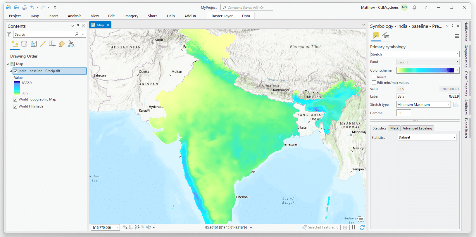
SimClim AR6 Climate Add-in for ArcGIS Pro
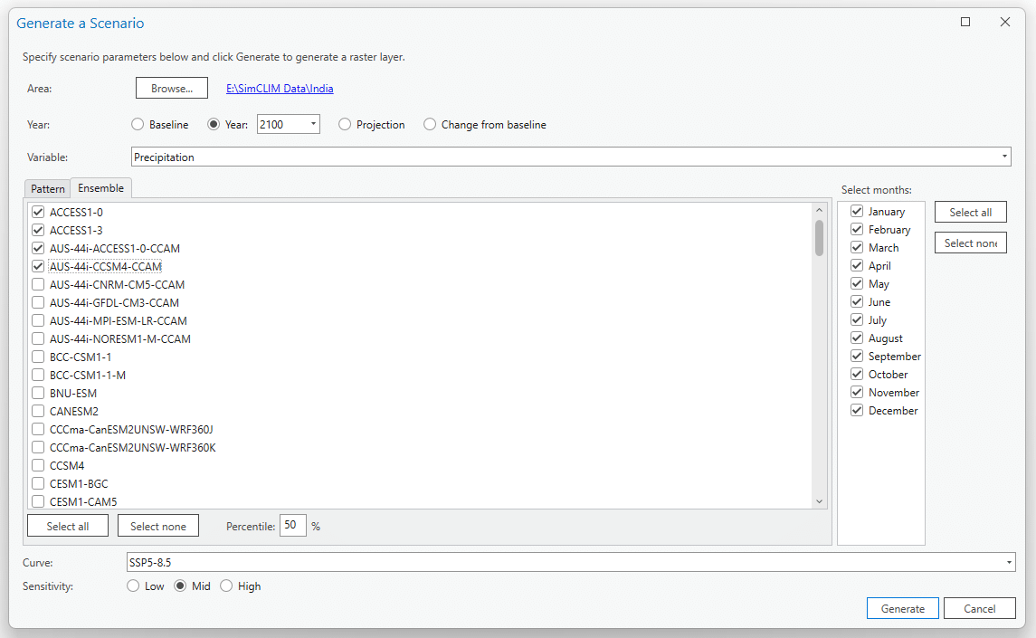
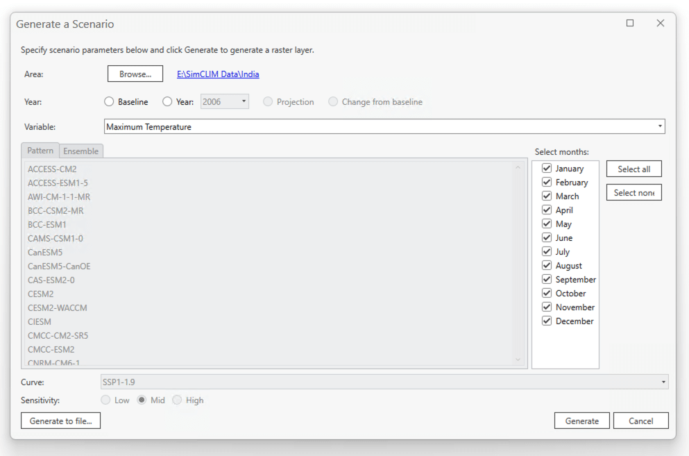
SimClim AR6 Climate Add-in enables ArcGIS users to produce spatial images of climate change through a quick, easy and straightforward process. The add-in is based on 20 years of development of the standalone SimClim AR6 tool and uses outputs from global climate models, produced for the IPCC. Both projections of future climate, and changes compared with the baseline climate can be produced.
- Spatial scenarios (given year, emission scenario, climate sensitivity, and GCM)
- Evaluate uncertainties stemming from different emission scenarios, climate sensitivities, and climate change models
- Ensembles on the fly
- Provides the latest global data for precipitation, mean-min-max temperatures
- Percentile results for ensembles
- Covers all of AR6 including:
- Comes with Global spatial dataset (0.5°x0.5° or ca. 50kmx50km)
- Can read SimClim AR6 spatial data packages
- All countries available (resolution dependent on country area, most 1kmx1km)
- Specific countries with states available on request
- Some continents available on request
- Purchase spatial patterns for regional and sub-national areas with much more detail than the global patterns e.g. bioregion, watershed, migration corridor.
7 Climate metrics included
Monthly averages of:
- Precipitation(mm)
- Mean Temperature(˚C)
- Minimum Temperature (˚C)
- Maximum Temperature (˚C)
- Solar (W/m2)
- Relative humidity (%)
- Wind speed (m/s)
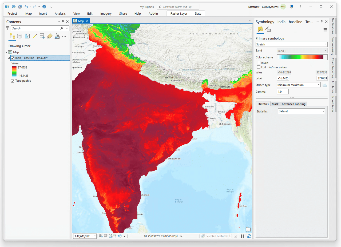
Preview
SimClim AR6 Marine Add-in for ArcGIS Pro
The SimClim for ArcGIS / Marine add-in is the only tool available in the world that gives access to the AR6 marine results. It can help you explore the impacts of climate change on marine biogeochemical cycles, sea level, and sea surface temperature. It is a user-friendly ArcGIS Desktop application launched as a toolbar. It allows you to evaluate uncertainties of ocean warming, offering less time-consuming analysis, and optimizing research costs as well as enhancing current capacity. It has a unique sea level rise dataset, with seasonal variation, including vertical land movement.
- Spatial scenarios (given year, emission scenario, climate sensitivity, and GCM)
- Ensembles on the fly
- Percentile results for the ensembles
- Extrapolated global coverage to simplify coast-line alignment
- Minimum, average, and maximum over the months selected
CMIP6 data which includes: - All variables with Global ocean coverage (0.25°x0.25° or ca. 25kmx25km)
Climate marine metrics:
- Sea level rise (cm) with optional vertical land movement
- Net primary production of carbon by phytoplankton (gC/m3/day)
- Dissolved nitrate concentration at surface (mmol/m3)
- Dissolved oxygen concentration at surface (mol/m3)
- Dissolved phosphate concentration at surface (mmol/m3)
- Dissolved iron concentration at surface (umol/m3)
- Dissolved silicate concentration at surface (mmol/m3)
- pH at surface
- Total alkalinity at surface (mol/m3)
- Sea surface temperature (˚C)
Pricing
Included in all licence types: one downscaled country dataset, user and data manual, and technical email support.

Single User License
$1,999 per year
- USD
- Includes a country dataset of your choice
- Additional countries or custom regions from $497
University Licence
$POA
- USD
- Options for any size course, lab or department
- Country datasets or custom regions available
Compare: SimClim AR6 vs SimClim for ArcGIS Pro
| Features | SimClim AR6 | SimClim for GIS - Climate | SimClim for GIS - Marine |
|---|---|---|---|
| AR6 | ● | ● | ● |
| Climate Variables | ● | ● | |
| Marine Variables | ● | ● | |
| Scenario Generator (spatial) | ● | ● | ● |
| Scenario Generator (site specific) | ● | ||
| SLR Scenario Generator | ● | ||
| Timeseries Data | ● | ||
| Extreme Events | ● | ||
| Impact Models | ● | ||
| Integrates with ArcGIS Pro | ● | ● | |
| Standalone program * | ● | GIS Pro required | GIS Pro required |
| macOS and Linux support | In development |
* SimClim AR6 is a stand alone program that runs on a computer as any other program. The SimClim AR6 Add-ins for GIS require the user to have ArcGIS Pro installed. If the user no longer has access to ArcGIS Pro, they will not be able to use SimClim AR6 Add-ins.